|
|
 |
File Photo
Wayne White | Managing Editor
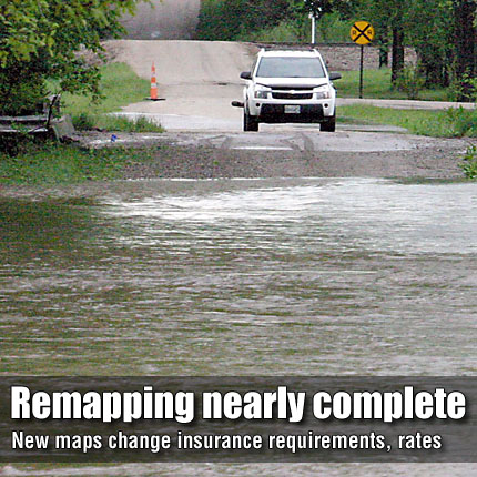
LYNDON—Whether someone thinks their property will flood or
not, recently revised flood plain maps could effect rates paid for
flood insurance, and will determine if owners can obtain flood insurance
or if lenders will require it.
The Osage County Commission and approximately two dozen local government
officials, bankers, real estate agents and insurance agents were
reminded Monday the revised maps would become effective in February,
at which time changes could occur in flood insurance for affected
properties.
Julie Grauer, mitigation specialist with Region 7 of the Federal
Emergency Management Agency (FEMA), explained the remapping project
was initiated about five years ago after congressional approval.
She said that previous maps were outdated, with some up to 30 years
old. Once the project was approved, the federal government partnered
with the state to revise the maps.
“Our object is to accurately portray your risk of flooding,”
Grauer said.
She said the project was nearing completion, with preliminary maps
being issued in March, and notification to communities in August
that they had six months to adopt the flood plain maps to allow
citizens to participate in the National Flood Insurance Program
(NFIP). As the maps become effective in February, property owners
could be affected by changes in flood insurance rates, eligibility
for NFIP, and lenders’ flood insurance requirements. About
90 parcels of land were added to the new flood maps, while others
were deleted.
The maps designate all areas that are subject to a 100-year flood
event.
“Any structure that is in the 100-year flood plain has a one
in 100 chance of getting flooded,” Grauer said.
The revision of the maps also had another effect – the flood
plain of the entire county is now designated. Previously, unincorporated
areas of the county were not mapped, putting those areas in FEMA’s
emergency phase, which limited flood insurance coverage to $30,000.
Structures in unincorporated areas of the county are now in FEMA’s
regular phase.
“Now you can get up to $250,000 (in coverage),” Grauer
said. “You can go to any insurance agent and get flood insurance.”
Incorporated areas of the county will also be in the regular phase
if those towns adopt the flood plain maps and NFIP by ordinance.
Anyone can purchase flood insurance, but NFIP, in which the governement
regulates the rates, is only available in areas that have adopted
the program.
Whether or not a property owner is required to have flood insurance
is dependent upon the mortgage lender for the property.
“If you don’t have a mortgage, you don’t have
required flood insurance,” Grauer said.
“If you have flood insurance, you will have a much better
time of recovering from a flood,” she said. “If somebody
thinks they can rely on FEMA funds to rebuild their house, they
will be sorely disappointed.”
Grauer explained that timing could be important in determining flood
insurance rates.
“It’s much better if you get your rate before the flood
maps go effective,” she said.
FEMA handouts explain that properties that move from a high-risk
area to a lower-risk area may be eligible for reduced insurance
rates, while those moved to higher-risk areas can lock in lower-risk
rates through grandfathering. For property to be grandfathered,
flood insurance must be purchased before the maps are effective
and coverage maintained without a lapse.
“We want property owners to be aware to make sure they take
advantage of any benefits available before the maps become effective,”
Grauer said.
Although the maps have been revised, Grauer and Tom Morey, state
NFIP coordinator, said there will be some areas indicated on the
maps as flood zones that are not in a flood zone.
“We’ll work with those property owners to get those
maps changed,” Morey said. He suggested obtaining a letter
of amendment and attaching it to the property’s deed to show
the property is not in a flood zone.
The new maps are available in the county land use coordinator Sheila
Dale’s office. Dale is also the county’s flood plain
manager. Maps will also be available in cities in the county that
participate in the program. Eventually, the maps will be available
on the Internet through federal, state and county Web sites.
In other business, the commission:
• approved an inter-local agreement between the county and
the city of Overbrook, which is seeking a community development
block grant (CDBG) for resurfacing Maple Street in Overbrook. Because
Maple Street is a county-city connecting link, the agreement pledged
$41,000 of county funds toward the improvements, contingent upon
the city receiving the CDBG.
• met with Chester Walker regarding his request for a portion
of Davis Road to be closed. Commissioners agreed to provide Walker
forms to officially request the road closure.
• finalized plans for removal of old, unused radiators in
the courthouse offices. The county recently received approval from
the Kansas State Historical Society to remove all of the radiators
except those in the courthouse hallways, which will be retained
for historical aesthetics.
• approved a resolution to establish the county’s emergency
preparedness position as the emergency management agency director
to meet state requirements. Bryce Romine serves in that position.
Commissioners also reappointed Bret Lewis, sheriff’s dispatcher,
and Osage County Sheriff Laurie Dunn as alternate emergency management
agency directors to serve in case of Romine’s absence. |
|
|
|
